
On 20 November 1980, water in a Louisiana lake began disappearing into the ground. A drilling platform vanished; boats, trees and parts of the shore followed. Beneath Lake Peigneur lay a working salt mine, and the water had found a route into it.
Water entering the excavated spaces lowered the lake surface. The connected canal then carried water toward the falling lake, reversing its usual flow. These linked processes explain how the flooding spread, while contemporary reports leave the precise first breach disputed.
Why was there a mine beneath the lake?#
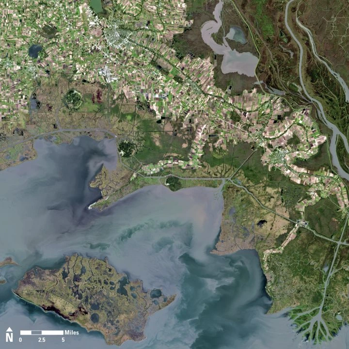
Lake Peigneur lies near Jefferson Island in southern Louisiana, north of the coastal waters of Vermilion Bay. Jefferson Island is one of the region’s salt domes: masses of buried salt that rose through overlying sediment and helped raise areas of higher ground above the surrounding lowlands. Salt is a mineral resource: its mineral form, halite, can occur as cubic crystals. Salt and oil both attracted industry to the area. Diamond Crystal mined salt underground, while a contractor for Texaco drilled an exploratory well from a platform on the lake.
A salt mine is not a single empty tank. Mining creates rooms and connecting passages as salt is removed, leaving material in place to support the rock above. Those excavated spaces gave incoming water somewhere to go. The lake’s shallow surface gave no obvious indication of the volume of workings below it.
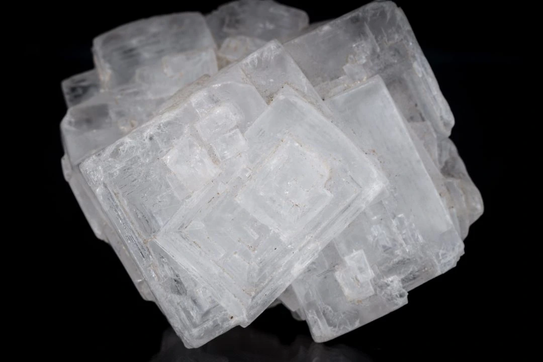
Image unavailable.
A cluster of pale translucent cubic halite crystals against a dark background.
How did the water reach the mine?#
The mine flooded and a large opening developed in the lakebed during the drilling operation. Contemporary accounts reported the drill becoming stuck, followed by the rig’s abandonment and the rapid growth of the opening. The familiar explanation is that the well penetrated a mined room, allowing lake water to enter. It is a plausible reconstruction, but the exact route into the mine and what initiated it were contested.
The day after the accident, UPI reported that officials were investigating whether drilling was responsible; an unnamed geologist raised the possibility that a rapid underground collapse and the drilling were unrelated. Later, Diamond Crystal’s lawsuit alleged that the well penetrated a room’s roof. The drilling contractor’s attorney said some experts disagreed. Those are competing claims, not direct views of the flooded workings. They leave a narrower, more defensible conclusion: the lake and underground mine became connected during the operation, but the precise initial failure cannot be established from these reports alone.
Why did the opening grow?#
Once a path existed, the water above it could flow down into the lower mine workings. The pressure difference and the available underground space made that connection consequential: the water had a destination, and gravity could sustain a flow toward it. As water moved through the opening, it could carry away loose sediment and undermine the walls. The contemporaneous report also raised rapid underground collapse as a possible contributor to the widening.
Salt adds a chemical process. Water that is not already saturated with salt can dissolve exposed salt, carrying it away as dissolved ions. Such incoming water can therefore enlarge a passage cut through salt, while erosion and collapse can change the opening and the ground around it. These processes can reinforce one another, but a simple diagram cannot establish how much each contributed at Peigneur or reproduce the unseen geometry. The precise sequence underground is an inference, not a filmed observation.
A whirlpool was the visible surface expression of converging flow. It did not mean that the original drill-sized passage alone remained unchanged while the whole lake passed through it. The growing crater, collapsing land and flooding mine were part of a changing system.
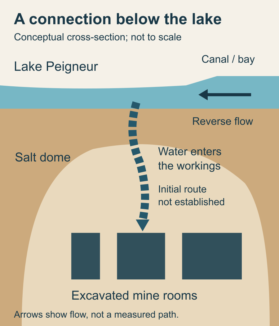
Image unavailable.
Conceptual cross-section showing a lake above a salt dome, water entering excavated mine rooms, and a reversed canal flow toward the lake.
Why did the canal run backward?#
The Delcambre Canal connected the lake with waterways leading toward Vermilion Bay. Under the ordinary conditions described by the day-after report, it carried water away from the lake. During the accident the lake surface fell rapidly as water escaped into the mine. The connected water on the canal and bay side then stood higher than the falling lake, so the difference in water level drove flow toward the lake instead.
This reversal was a response to a changed slope in the water surface, not a change in the canal’s construction. Water arriving from the coast fed the depressed basin and, while the underground connection continued to accept water, helped supply the inflow. UPI described a waterfall effect at one end of the crater and reported the next day that the lake was filling again. The report was written during a rapidly developing event; it is not a survey of the waterfall’s height or the volume transferred.
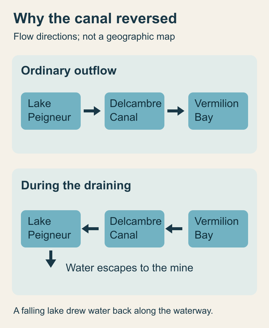
Image unavailable.
Two flow diagrams compare ordinary outflow from Lake Peigneur toward Vermilion Bay with the reversed flow during the draining, when water also escaped toward the mine.
Sources: [1]
How did people escape?#
The day-after UPI account reported that seven workers abandoned the drilling rig and approximately 50 fled the mine. Two fishermen told the reporter they tied their boat to a tree and ran ashore. As land cracked and collapsed, families and other workers were evacuated from Jefferson Island. UPI reported no injuries in that account.
The escape matters because the danger was not confined to the rig. An opening on the lakebed threatened people underground, and the collapse propagated to the shore. The evacuation numbers in early reports are rounded and do not by themselves verify later exact counts of miners, barges or animals. Those figures are often repeated together, but each needs its own evidence.
Sources: [1]
What remained after the water returned?#
The returning water covered a changed basin. UPI reported that the mine appeared to be a total loss, that parts of Live Oak Gardens had collapsed and that a natural-gas fire continued at the site after the initial event. A week later, crews were clearing debris and dredging Bayou Carlin and the Delcambre Canal where objects could obstruct navigation. The event also displaced workers and families. The destruction was more than a temporary drop in water level: material and structures had fallen into the crater, and the lakebed and underground workings no longer had their former shape.
Accounts differ on the water’s pre-accident character. The day-after UPI report described Peigneur as brackish, meaning a mixture containing more salt than fresh water, while a later Louisiana historical account calls it freshwater. The reverse flow brought coastal water into the lake, and dissolution could add salt to water in contact with the mine. Those facts do not establish a precise before-and-after salinity change. A measured water-quality record would be needed to resolve it.
Did a settlement establish what went wrong?#
No. In 1983 UPI reported that Diamond Crystal accepted an out-of-court settlement from Texaco and Wilson Brothers, and that a separate settlement compensated the garden owners. It also recorded the disagreement over whether the well actually entered the mine. A settlement resolves claims between parties; it is not a finding that a particular measurement or map was wrong.
The reports document a destructive connection between surface water and underground excavations. They establish the outcome more clearly than the initiating failure.
Keep exploring
Sources & further reading
Follow the original research, records, and explanations behind this story.
- Drilling rig breaks into salt mine cavity, draining lake United Press International
Contemporaneous reports of flooding, evacuation, reverse canal flow, and uncertainty.
- Settlement reached in Jeff Island accident United Press International
Settlement and competing positions about whether the well pierced the mine.
- Gas well flame goes out at salt dome site United Press International
Evacuation, site fire and cleanup a week after the accident.
- Lake Peigneur Drilling Accident 64 Parishes, Louisiana Endowment for the Humanities
Later overview of local setting and historical activities; its specific blame and salinity assertions are contested.
- Karst landscapes are more prone to have land subsidence and sinkholes. U.S. Geological Survey
General dissolution of salt and collapse of subsurface cavities, not an investigation of Lake Peigneur.
- Landsat 8 Image of the Salt Dome Islands of Louisiana U.S. Geological Survey
Public-domain Landsat image and general description of Louisiana’s five coastal salt dome islands.
- Salt, Sodium, Chlorine U.S. Geological Survey
Public-domain photograph of a halite specimen and mineral identification.
See the story in motion
Watch our illustrated video, then explore another question below.
Watch on YouTubeFollow the thread