
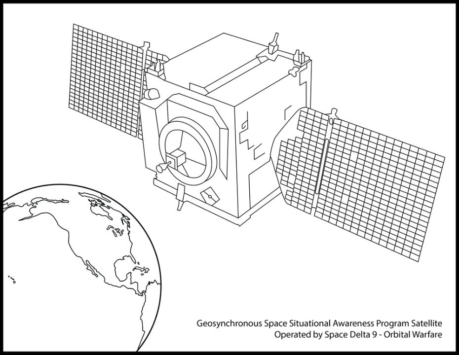
A satellite can have another satellite as its subject. The United States’ Geosynchronous Space Situational Awareness Program, or GSSAP, observes human-made objects near the geosynchronous region. Its public mission includes approaching objects of interest to gather information.
That makes it an unusual kind of observatory: its viewing position can change relative to the spacecraft being watched. Understanding how such an encounter works helps separate three questions that are easily confused: where a satellite is, what an observer can learn about it, and why the observer came.
What is special about the geosynchronous region?#
A geosynchronous orbit takes one Earth rotation to complete: about 23 hours and 56 minutes. For a circular orbit, that corresponds to roughly 36,000 kilometres above Earth’s surface. The period, rather than a particular job or spacecraft design, gives the orbit its name.
Geostationary is the more restrictive case. A satellite travelling in a circular orbit above the equator, in Earth’s direction of rotation, can remain over the same place on the ground. A geosynchronous satellite with an inclined orbit can move north and south in the sky instead.
This is valuable territory for communications and weather observation. It also creates a reason to understand the other objects in the region. Sharing a broad orbital neighbourhood does not mean two spacecraft are close together, and appearing still from Earth does not mean either has stopped moving.
Sources: [2]
What does watching from space add?#
The Space Force describes GSSAP as a source of tracking and characterization data. Tracking concerns an object’s motion; characterization asks what can be learned about the object itself. The mission description also includes helping investigate anomalies and improving orbital predictions for collision avoidance.
An observer above the atmosphere avoids clouds and atmospheric interference along a space-to-space line of sight. Moving the observer also changes the viewing geometry. These advantages do not make every subject equally visible: distance, illumination and the observing instrument still matter.
Consider a purely geometric example. If the distance to an object is halved, a feature of fixed size spans roughly twice the angle at the observer, provided the feature is small compared with the distance. Whether a real sensor can resolve that feature is a separate question. This example supplies no GSSAP resolution, operating distance or image of another satellite.
The official graphic accompanying this article is a public illustration of GSSAP. Its recognizable spacecraft form must not be read as a photograph of hardware or evidence of an actual encounter.
How can an observer catch up without flying straight at its subject?#
The useful speed is the speed relative to the other spacecraft. In an ideal model, two satellites in the same circular orbit keep their separation: pointing one toward the other does not make the gap close.
One way to change that separation is to use a slightly lower orbit, nearer Earth. Its shorter orbital period lets the observer gain angle on a spacecraft farther ahead. Subsequent manoeuvres can bring their orbits and relative motion into the arrangement needed for observation. NASA’s satellite-servicing study describes this general approach; it is an explanatory example, not a disclosed GSSAP route.
Rendezvous brings spacecraft into a planned encounter. Proximity operations manage their motion while they are nearby. Neither term requires contact. The task can end with observations and separation, whereas docking adds the separate act of physically joining vehicles. The distinction also matters in Gemini 8’s docking story.
A nearby observer therefore needs more than a destination. It needs knowledge of relative position and motion, a suitable trajectory, and a way to avoid collision. NASA’s public rendezvous work explicitly includes guidance, navigation and collision-avoidance techniques. A diagram of two satellites side by side leaves all that control work out.

Image unavailable.
Three panels show an equal-orbit gap persisting, a lower-orbit observer gaining angle, and a planned encounter requiring controlled relative motion.
Does an approach show that an attack has happened?#
A damage claim needs evidence beyond an observed approach.
Secure World Foundation’s public summary of its U.S. military and intelligence RPO fact sheet, dated 12 June 2026, reports no evidence that the missions it reviewed were used to damage or disable satellites. That is a bounded research finding about the reviewed activities. It cannot certify every intention, disclose every capability or guarantee a future outcome.
The distinction matters because inspection and servicing share enabling skills with more threatening uses: detecting another spacecraft, manoeuvring toward it and controlling relative motion. Calling a capability dual-use identifies that overlap. It does not identify the purpose of a particular encounter.
Sources: [5]
What could make an inspection less ambiguous?#
An advance explanation could help another operator interpret an approach. It would not, by itself, prove the explanation true.
Imagine that the approached spacecraft is yours. A visitor moves nearby and leaves it intact. You may have observed the path without learning what information the visitor collected or what its operator intended. This is a hypothetical dilemma, not a report of a particular GSSAP encounter.
The practical question becomes what information would let the two operators judge the encounter more reliably. Advance notice, a stated purpose and a shared understanding of the planned motion could reduce some uncertainty. These are possible confidence-building measures, not claims that GSSAP follows a particular notification procedure or that one universal rule governs every approach.
An inspection can improve knowledge of a spacecraft while leaving its owner uncertain about the inspector. Orbital measurements help answer what moved where. Understanding intention requires context beyond the moving points.
Sources: [5]
Keep exploring
Sources & further reading
Follow the original research, records, and explanations behind this story.
- Geosynchronous Space Situational Awareness Program U.S. Space Force
Public mission description: tracking, characterization, anomaly resolution, RPO and orbital predictions. Page marked current as of October 2021; no current fleet count inferred.
- Catalog of Earth Satellite Orbits NASA Earth Observatory
Orbital period, approximate altitude and distinction between geosynchronous and geostationary orbits; only stable orbital mechanics used.
- On-Orbit Satellite Servicing Study Project Report NASA Goddard Space Flight Center
October 2010, printed page 59 / PDF page 68: Astrodynamics and illustrative lower-orbit rendezvous strategy. Not a description of GSSAP operations.
- Rendezvous, Proximity Operations & Docking Subsystems NASA Johnson Space Center
Separate rendezvous, proximity operations and docking functions; guidance, navigation, collision avoidance and separation planning.
- US Military and Intelligence Rendezvous and Proximity Operations Fact Sheet Secure World Foundation
Publisher summary dated June 12, 2026: dual-use context, governance considerations, and bounded finding of no evidence of damaging/disabling uses in reviewed U.S. RPO missions. Attached publication not read.
- GSSAP satellite for National Coloring Book Day DVIDS / Space Base Delta 1
Graphic by Cody Friend dated August 1, 2023, VIRIN 230731-X-OF631-1001; explicitly marked public domain. Illustration, not a spacecraft photograph.
Follow the thread