
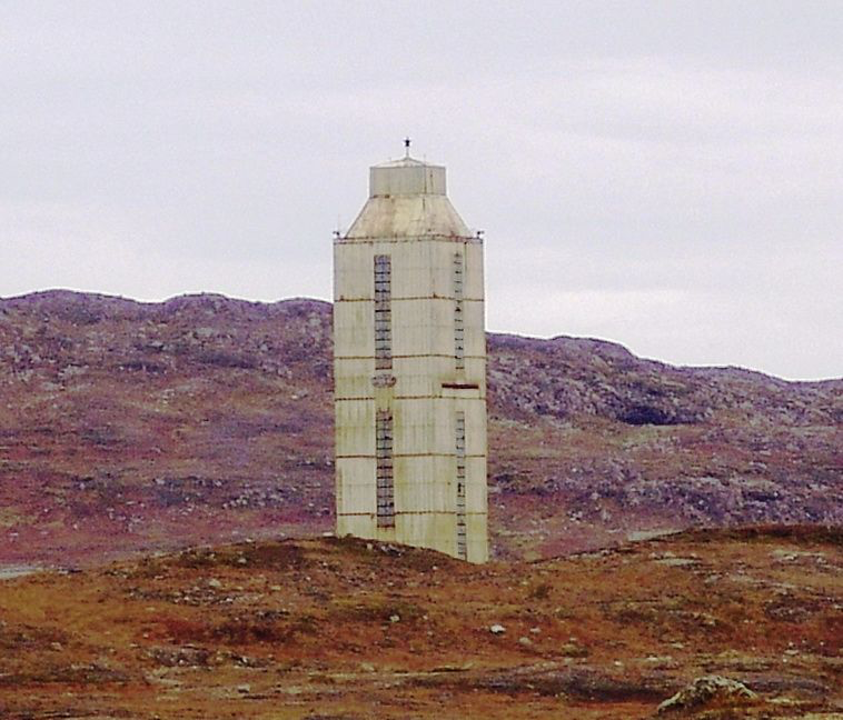

The Kola Superdeep Borehole reached 12,262 meters beneath Russia’s Kola Peninsula: a little over 12 kilometers, or 7.6 miles. It took years of drilling to reach that depth, and the hole stayed within Earth’s crust.
Kola gives a direct view of a narrow part of continental crust. Interpreting it means distinguishing vertical depth from the drilled path and comparing rock samples with measurements made inside the hole.
How deep was the hole, really?#
The deepest Kola branch, known as SG-3, reached 12,262 meters in 1989. A 2026 scientific review describes it as the deepest vertical borehole and reports that the original target was 15 kilometers. This is a depth record, not necessarily a record for the longest path drilled through rock.
Vertical depth measures the downward distance from the surface. Measured well length follows the actual path of a borehole. A well that curves or travels sideways can have a longer path while ending at a shallower vertical depth. The distinction matters when comparing Kola with modern directional wells. Kola itself was slightly deviated, so its reported depth should not be treated as an independently verified, perfectly plumb measurement to the nearest meter.
Using the US Geological Survey’s approximate Earth diameter of 12,750 kilometers gives a radius of about 6,375 kilometers. Dividing 12.262 by 6,375 gives roughly 0.19 percent of the distance to the center. That is a comparison of distances, not a claim that the drill was headed for the core. Even the deepest point in the ocean and a borehole measure different things: water depth is measured down to the seafloor; Kola continued down through rock.
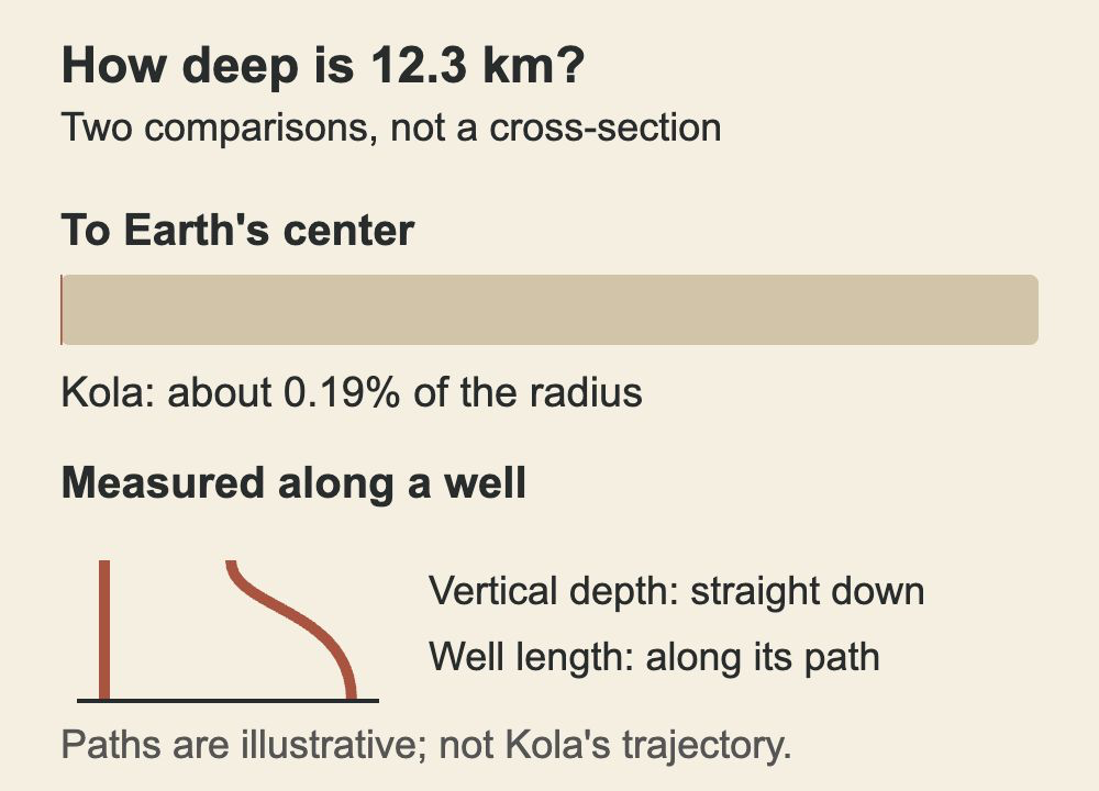
Image unavailable.
A thin mark shows Kola’s depth as about 0.19 percent of Earth’s radius; two paths illustrate vertical depth and well length.
Why drill there?#
Kola was a scientific project aimed at investigating continental crust. A drill brings up cores—cylinders of rock cut from selected intervals—and instruments can make measurements inside the hole. Together, samples and logs let geologists compare the actual rock and its physical properties with interpretations made from the surface.
For example, seismic waves change speed as they pass through different materials and structures. A change in their behavior can suggest a boundary, but it does not uniquely identify the rock on either side. The 2026 review describes Kola’s profile as a transition from younger overlying rocks into ancient crystalline gneiss, rather than the simple granite-over-basalt sequence once expected there. A single borehole provides a narrow sample of a complicated region, so it is a check on a model, not a complete map of every part of the crust.
Sources: [1]
What did the rocks and measurements reveal?#
The deep crust at Kola contained fractured, fluid-bearing rock. Cracks and fault zones can provide routes for fluids even in crystalline rock that might look solid and impermeable at the surface. That does not mean drillers found an open underground sea: fluid in rock can occupy fractures and small spaces.
Cores show minerals, texture and traces of alteration, while measurements in the hole provide another view of conditions at depth. Each has limits: bringing a sample to the surface changes its pressure and temperature, and a borehole log measures properties indirectly. Read together, these kinds of evidence help researchers test where fluids could move and how rocks have changed. Elsewhere, the Lake Peigneur drilling accident shows how a hole can connect very different underground environments; its salt-mine collapse was a different event from Kola’s scientific investigation.
Sources: [1]
Why did drilling stop?#
Heat, pressure and the stability of the hole made progress increasingly difficult. A 2026 review reports temperatures of 180°C at 10 kilometers and 212°C at 12 kilometers in Kola. Heat can wear or damage tools and affect drilling fluids; stressed rock can deform and narrow a borehole, making equipment harder to move. The review reports that drilling was abandoned in 1992 and associates the termination with unexpectedly high heat and rock deformation.
The reported temperatures are individual values from a scientific review, rather than a continuous temperature record. They do not establish the temperature at every depth or under every drilling condition.
Sources: [1]
Did it reach the mantle?#
No. Kola remained in the continental crust, above the boundary geologists call the Moho. Crust thickness varies from place to place, so a fixed depth does not have the same geological meaning everywhere. The USGS gives an average continental crustal thickness of about 30 kilometers, with substantial regional variation.
The mantle below is hot rock. Much of it is solid, although over geological time hot solid rock can deform and flow slowly under stress. Some regions can partially melt and generate magma, but the mantle as a whole is not a global ocean of liquid lava. Scientists infer its structure from seismic waves and other evidence, and examine mantle material brought to the surface by geological processes; Kola’s cores are direct samples of crust at that one site, not samples drilled directly from the mantle.
Keep exploring
Sources & further reading
Follow the original research, records, and explanations behind this story.
- Ultradeep drilling beyond 10 km revealing new insights into Earth systems and resources Communications Earth & Environment
Kola depth, scientific results, geological profile and drilling conditions; a synthesis, not original temperature logs.
- Inside the Earth U.S. Geological Survey
Approximate Earth diameter, crustal thickness and mantle structure.
See the story in motion
Watch our illustrated video, then explore another question below.
Watch on YouTubeFollow the thread