

The Sahara supported cattle and the communities who herded them during wetter periods. Their rock paintings survive in shelters that now stand in a dry landscape.
The paintings are one part of the evidence. Sediments, pollen and animal remains help reconstruct the wetter environment, while climate research explains why rainfall changed. This evidence shows that rainfall and vegetation varied by region, even during the wetter periods.
Why are cattle painted in the Sahara?#
Cattle were part of the lives of communities who occupied the Sahara in the past. At Tassili n’Ajjer in southeastern Algeria, rock paintings and engravings include scenes of cattle and human social life. They are evidence of what artists chose to depict, although a picture by itself cannot tell us exactly when it was made or why its maker painted it.
Other archaeological evidence places herding in a wider history. A synthesis of dated finds describes domestic cattle, sheep and goats spreading across northern Africa after about 7,000 years ago. Pastoralism means making a living in part by raising and moving livestock; it was one of several ways people used the region, not the occupation of every person who lived there.
How do we know the Sahara was wetter?#
Independent traces survive beyond the paintings. At Takarkori rock shelter in southwestern Libya, excavators found fish bones alongside other animal remains in layers spanning roughly 10,200 to 4,650 calibrated years before 1950. Former lake and marsh sediments nearby provide separate physical evidence of water. The fish remains became less common relative to mammal remains over time, and the fish became smaller: the researchers interpret those changes alongside increasing aridity. Food choices and preservation also affect what survives, so a bone count is not a rain gauge.
In Morocco, pollen preserved in a dated Lake Tislit sediment core records changes in surrounding plants. Researchers compared the fossil pollen with the climates in which related plants grow today to estimate past seasonal rainfall. Their reconstruction indicates a wetter northern region, particularly in winter and spring. It is an estimate from one site and its surrounding region, not a direct measurement of rainfall across the entire Sahara.
How could Earth’s orbit change the rain?#
Earth’s axis slowly wobbles, changing when the Northern Hemisphere’s seasons occur along its orbit. During the last African humid period, this helped increase the sunlight received in northern summer. Stronger summer heating over land helped intensify and push the West African monsoon farther north: moist air arriving from the Atlantic rose, cooled and produced rain over areas that are now much drier.
More rain supported vegetation. In climate models, changes to vegetation and other land-surface properties can reinforce rainfall changes, so the landscape responds to the monsoon and also influences it. Lakes and wetlands store water and supply moisture to the air through evaporation; their effects depend on location and conditions. The size of these feedbacks is uncertain, and many models still struggle to reproduce the full wetness inferred from geological evidence.
The monsoon was not the only source of moisture everywhere. The Lake Tislit study proposes that increased winter rainfall from the Mediterranean and North Atlantic reached the northern Sahara, while summer monsoon rain reached from the south. Its vegetation-model experiment found that this seasonal combination could support more vegetation than an increased monsoon alone.
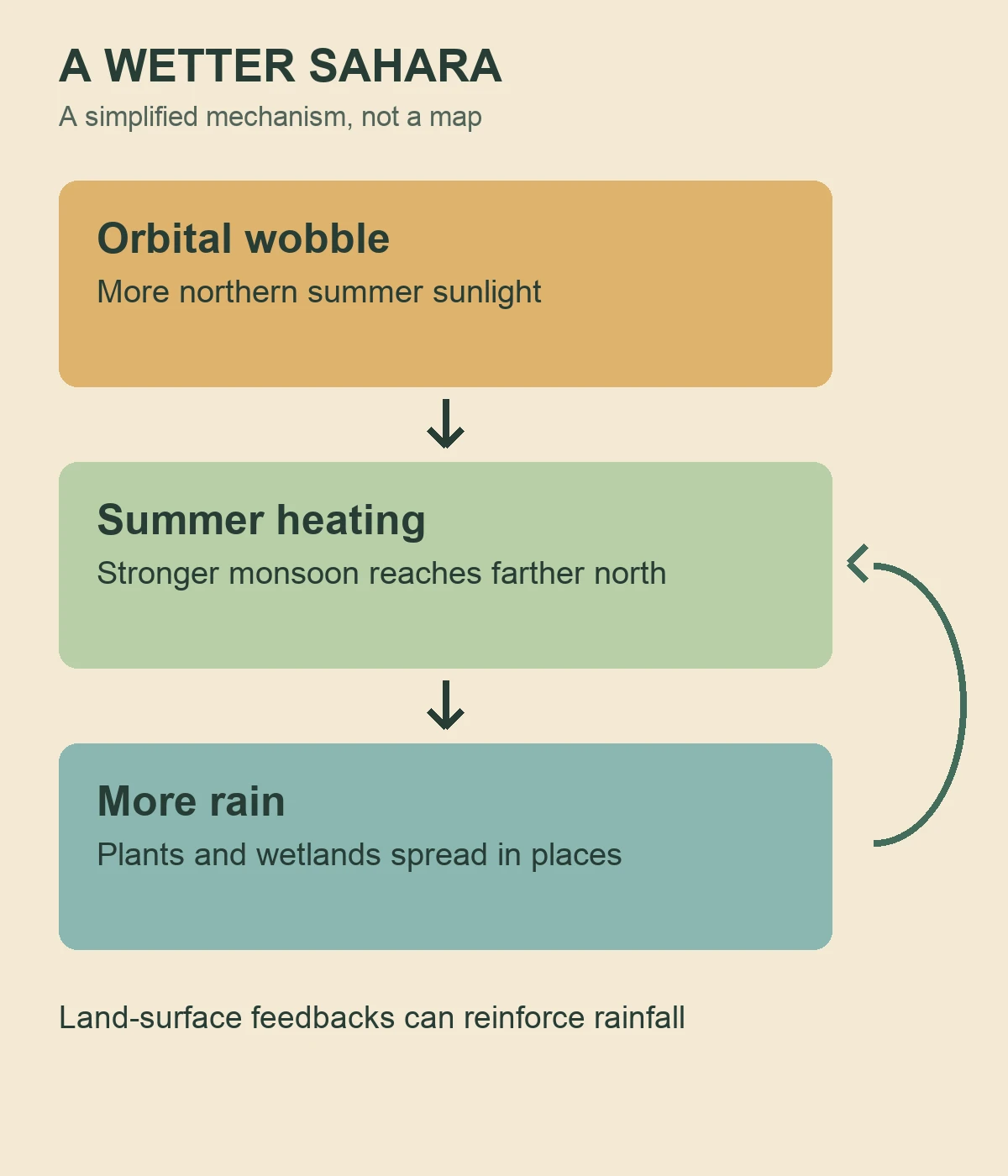
Image unavailable.
Diagram connecting orbital changes, summer heating and a stronger monsoon to increased rain, with a feedback arrow from the wetter landscape.
What happened as the region dried?#
The most recent African humid period is commonly placed roughly between 14,500 and 5,000 years ago, with interruptions and local variation. As the orbital configuration changed, northern summer sunlight weakened and the monsoon receded. A broad drying trend followed, but it was not a single switch thrown across the whole Sahara.
Different records describe different rates: some marine sediment records suggest a rapid shift around 5,500 years ago, while pollen and sediments at Lake Yoa in Chad show a more gradual regional change. Local water stores also mattered. In the Libyan central Sahara, wetlands connected to larger water reservoirs lasted longer than those fed by shallow water sources, according to the Takarkori study. People adapted to changing conditions in different ways, including livestock herding; neither a painting nor a single lake record can map every community’s movements.
Keep exploring
Sources & further reading
Follow the original research, records, and explanations behind this story.
- Tassili n'Ajjer UNESCO World Heritage Centre
Cattle-period art and archaeological context at Tassili.
- Aquatic fauna from the Takarkori rock shelter reveals the Holocene central Saharan climate and palaeohydrography PLOS ONE
Animal remains, wetland deposits, and local drying.
- Early Holocene greening of the Sahara requires Mediterranean winter rainfall Proceedings of the National Academy of Sciences
Pollen-based seasonal rainfall reconstruction and vegetation model.
- North African humid periods over the past 800,000 years Nature Communications
Orbital pacing, monsoon response, and model limitations.
- Pastoralism may have delayed the end of the green Sahara Nature Communications
Archaeological synthesis and differing records of drying.
See the story in motion
Watch our illustrated video, then explore another question below.
Watch on YouTubeFollow the thread